Marin County arguably has the best running in the entire Bay Area. You can find everything from mountainous trails with 360 degree vistas, to forests of pines, redwoods, and madrones, to hills flanked by huge oaks, and of course, coastal trails with views of the Pacific Ocean. I’m going to highlight some of the different areas of Marin County in this post and will (eventually) have individual blog posts for each.
The Headlands
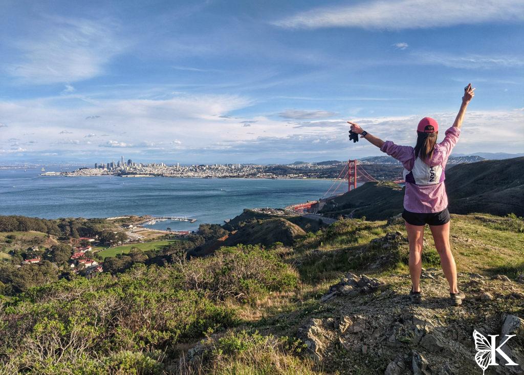
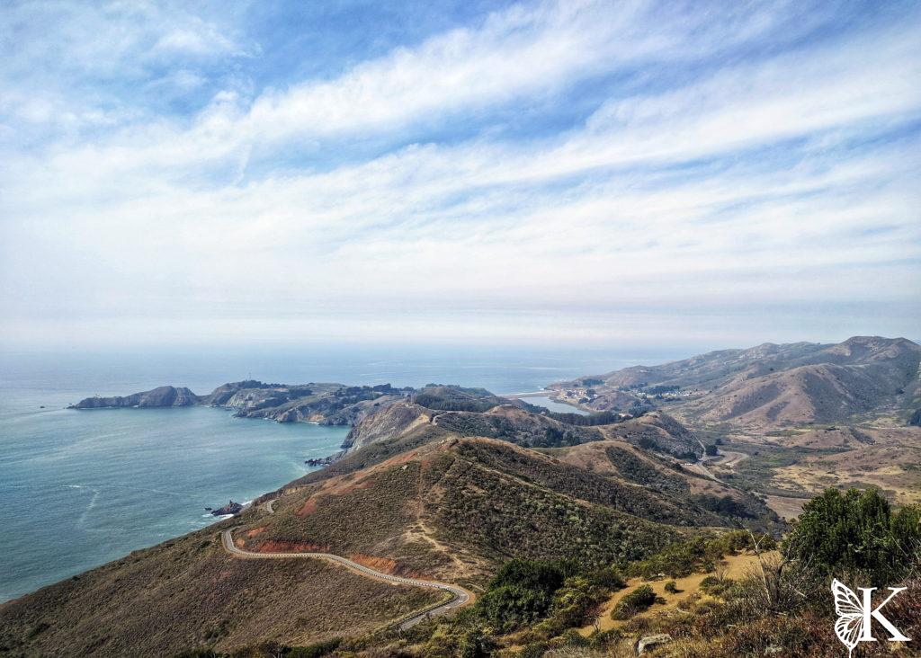
The Marin Headlands are one of the most popular public trail areas. Tennessee Valley is the central hub of this area. The parking lot is packed by mid-morning on weekends and busy just about every day – and for good reason. To the South, you can climb up Marincello or Old Springs Trail to SCA Trail and reach Slacker Hill and Hawk Hill for close up views of the Golden Gate Bridge and San Francisco, then head down into Rodeo Valley. To the North, you can climb up either Coastal Trail or Miwok and make a loop on the high ground, or head down to Muir Beach. To the West you can take an easy 3.5 mile (round trip) run to Tennessee Beach.
Capable long distance trail runners might choose to go further and either cross the Golden Gate Bridge, heading South, or push out to Stinson Beach or Mount Tam to the North. These are long runs with big climbs! That’s exactly why these trails are used by so many local races. Hike the big uphills and save your energy for the descents and the flat ground (which is a rare commodity).

 Water and Toilet Situation:
 All the major trailheads in the Headlands have pit toilets. The only trailhead with running water in the headlands is Rodeo Valley (by the bathrooms at the beach parking lot).
Mt. Tam

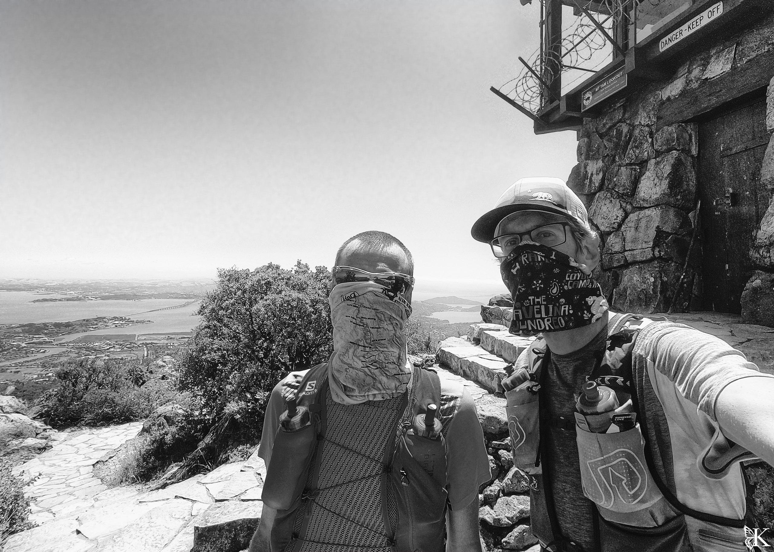
Mt. Tamalpais, or Mt. Tam as everyone knows it by, is the most prominent and central running destination in all of Marin County. The East Peak of Tam is also the highest point in Marin County. There are trails leading to the summit from Mill Valley, Muir Beach, Stinson Beach, the Watershed in Ross, Fairfax, and Bolinas. A popular and relatively easy route up Tam starts at the Ross Post Office and proceeds to Phoenix Lake, then up Eldridge Grade, which is a very steady climb up the fire road. This won’t quite scratch the itch for single track, but it’s still scenic and much easier to follow. Temelpa Trail from Mill Valley is short, steep, and gnarly for a different experience!
Water and Toilet Situation: There are toilets and running water at the East Peak summit and at the Mountain Amphitheater, near Rock Springs. Water on the mountain can also be found at the Pantoll Parking lot, Cardiac Hill, and at the West Point Inn.
Mill Valley
Mill Valley is known as the home of the Dipsea Race, which runs from Old Mill Park to Stinson Beach and involves a couple of big climbs and many, many stair steps leading both up and down. It’s fun to go “find” the trail for first timers, because it winds through the hillside neighborhoods in the redwood trees of Mill Valley as you climb your way up the famous steps.
There are other trails in the area of the Dipsea Steps and Mountain Home Inn that are lesser known but totally worth checking out, including Cypress and Tenderfoot, which can make a nice loop back down to Cascade drive and eventually Old Mill Park.
The Temelpa Trail is also accessible from the downtown area and climbs steeply and directly up to the East Peak of Mt. Tam. It’s short but punchy! Be prepared to scramble a little! It’s a good spot to run. Equator Coffee is an essential pre- or post-run stop!
Water and Toilet Situation: Old Mill Park has toilets and water. Cardiac Hill along the Dipsea route also has water.
Fairfax & San Anselmo
These areas are also very centrally located and, like the rest of Marin, are networked into a ton of trails. Jumping off points are Ross Post Office, Deer Park, the Mt. Tam Watershed day use area, Tamaranco, and Brown Bridge/White Hill, to name a few. Destinations include the Watershed trails, Mt. Tam, Pine Mountain, and Loma Alta. These trails are in a hotter and drier climate than other areas of Marin, so be ready for that in the Summer. There are some cool and different views from the trails to the North of the Watershed. Runners are ok in Tamarancho, but you should avoid running on the “flow trail” (Endor Trail) because it is meant for fast downhill mountain bike traffic.
This area is also one of the few spots with some good (legal) singlet rack mountain biking options in Marin County. Tamarancho is a nice trail network with some decent technical single track and mostly fast and flowy downhill riding. The Endor Flow Trail is like a mini version of Flow Trail from Demo Forest in Santa Cruz. This can be linked up on the other side of Sir Francis Drake with Smith Ridge Fire Road to 680 Trail, then down Solstice Trail, which is a very fun and technical enduro-style downhill trail (this is an advanced trail that’s very rough, steep, and has some drops). These trails are on private land that is open to the public. You need a day pass for Tamarancho and you just need good manners and some bike handling skills for Solstice.
Water and Toilet Situation: This really depends where you start. Not many of the trailheads in these areas have facilities. There is water (no toilets) available about half way into the Tamarancho trail network, the Watershed staff office and parking lot near Lagunitas Lake, which also has toilets nearby.
Novato and Terra Linda
These more suburban areas have a few surprises of their own. From Big Rock off Lucas Valley Road just outside Terra Linda, you can access the fire road leading up to Loma Alta. From there, you can connect to 680 Trail (this is a mountain bike legal single track too) and either head down to Terra Linda or San Anselmo. Alternatively, you can climb up the single track on the North side of Lucas Valley Road from Big Rock and connect to the fire road that will keep climbing to reach “the towers,” which are radio towers sitting at the highest point of the ridge. This ridgeline will take you back to Terra Linda via either Queenstone or Ponti (another new mountain bike legal single track) or into Novato, should you keep taking junctions to the North. This is some very hilly running with great views. In the Spring, everything is green and can have great wild flowers approaching summer.
In Novato, Rush Creek is a small trail system along the bay that offers easier running along the bottom, about half of which is in the shade, or more difficult running heading up the hills. Mt. Burdell offers big climbs and good views from the top. My favorite place to run in Novato is actually among my top picks for Marin County, although it’s a little out of the way. At the end of Vineyard Road, there is a small trail system called Indian Trees. Single tack trails climb up at a runnable grade to Ships Mast Trail and eventually Big Trees Trail. These trails go through a pocket of redwood trees that is very unexpected. It’s a great ~ 7 mile loop that climbs half way, then descends. In the afternoons, it’s not uncommon for the marine layer to get filtered in through the valleys connecting to the coast (hence the redwood trees) resulting in some surreal and dramatic lighting and experiences!
Water and Toilet Situation: None of these locations have toilets or water. Plan accordingly.
China Camp
This little State Park has a cool trail system that is worth checking out. The North side of the park has about 10 miles of trails, plus some shorter side trails. Some of these trails have been made accessible for people who have physical limitations. The trails climbing higher up the hillside get a little rougher and are enjoyed by both runners and mountain bikers. The trails on the South side of the park are actually not part of the park jurisdiction. They are some of the better trails and somewhat less travelled on. It’s easy to get turned around out there as almost none of them are signed! Mountain bikers ride all these trails (there is also an incredible network of social trails).
The park is entirely run by a volunteer organization and receives no state funding. Please buy a trail pass to support the park and those who work to keep the trails maintained!
Water and Toilet Situation: Water and toilets are available at the campground and in the day use areas that are spread out along North San Pedro Road. This is all on the North side of the park. No toilets or water are available on the trail system South of the ridge.
Point Reyes
I saved the best for last! Point Reyes is a gem. Many of my favorite trails to run in Marin County are found at Point Reyes. This is a National Seashore, which has the same status as a National Park. There is no cost for entrance, parking, or trail use though – which is nice! The trails are situated among incredibly vibrant forests and emerge from the trees onto coastal bluffs and beaches. There are a handful of trailheads to start from including Bear Valley (the visitor center), Five Brooks, Sky Trail, Muddy Hollow, and Palomarin, which is the most direct access to Alamere Falls (and usually overcrowded).
Sky Trail is my all time favorite, Even after the Woodward fire, the area is still top notch. The forest is coming back already. You can either start low, climb to Sky Trail using either Horse Trail (recommended) or Meadow Trail (also great) run along the ridge, then loop back to the start. Or combine running along Coastal with Sky Trail to get views of the Pacific Ocean and the forest. There are a lot of options. I recommend avoiding Baldy trail due to overgrowth of nettles and blackberries!
Five Brooks presents you with more options. Go up Stewart Trail (really a fire road), Green Picker Trail (very cool trail), or head South and take Olema Valley Trail to Bolema Trail, then to Ridge Trail or Lake Ranch Trail. These are longer loops (14 – 17 miles) with lots of climbing – but they are SO good! These are my favorite running options in the park for total immersion in the forest with fewer people. You may encounter horses on the trails immediately around Five Brooks. They’re not allowed further into the forest.
Tomales Bay and Tomales Point also offer trails to run on that are incredible and worth a visit when you have time to drive a little further. You can hop onto the Jepson Trail outside of the State Park and run into the park using the Jepson, Johnstone, and Indian Beach Trails. You can also drive to the end of Pierce Point Road (a bit of a haul) and run the Tomales Point Trail to see some Tule Elk and experience one of a kind views.
Water and Toilet Situation: The visitor center in Bear Valley has water and toilets. None of the other trailheads have water except near Limantour Beach, coming from Muddy Hollow. Water is available at each of the campgrounds within the park – just check ahead that it’s running and ok to use. There have been past issues with the pipes. There is water in the State Park at Heart’s Desire Beach, as well as toilets. Tomales Point has toilets but no water.
In Summary
Marin County is a paradise for outdoor activities, especially for running. It’s easy to put in higher mileage runs when you find a place that excites you and makes you feel restored after running. I’m lucky to live among such great trail systems and to be able to take advantage of them all year round.

 Water and Toilet Situation: All the major trailheads in the Headlands have pit toilets. The only trailhead with running water in the headlands is Rodeo Valley (by the bathrooms at the beach parking lot).
 Mt. Tamalpais, or Mt. Tam as everyone knows it by, is the most prominent and central running destination in all of Marin County. The East Peak of Tam is also the highest point in Marin County. There are trails leading to the summit from Mill Valley, Muir Beach, Stinson Beach, the Watershed in Ross, Fairfax, and Bolinas. A popular and relatively easy route up Tam starts at the Ross Post Office and proceeds to Phoenix Lake, then up Eldridge Grade, which is a very steady climb up the fire road. This won’t quite scratch the itch for single track, but it’s still scenic and much easier to follow. Temelpa Trail from Mill Valley is short, steep, and gnarly for a different experience!
Water and Toilet Situation: There are toilets and running water at the East Peak summit and at the Mountain Amphitheater, near Rock Springs. Water on the mountain can also be found at the Pantoll Parking lot, Cardiac Hill, and at the West Point Inn.

 Water and Toilet Situation: All the major trailheads in the Headlands have pit toilets. The only trailhead with running water in the headlands is Rodeo Valley (by the bathrooms at the beach parking lot).
 Mt. Tamalpais, or Mt. Tam as everyone knows it by, is the most prominent and central running destination in all of Marin County. The East Peak of Tam is also the highest point in Marin County. There are trails leading to the summit from Mill Valley, Muir Beach, Stinson Beach, the Watershed in Ross, Fairfax, and Bolinas. A popular and relatively easy route up Tam starts at the Ross Post Office and proceeds to Phoenix Lake, then up Eldridge Grade, which is a very steady climb up the fire road. This won’t quite scratch the itch for single track, but it’s still scenic and much easier to follow. Temelpa Trail from Mill Valley is short, steep, and gnarly for a different experience!
Water and Toilet Situation: There are toilets and running water at the East Peak summit and at the Mountain Amphitheater, near Rock Springs. Water on the mountain can also be found at the Pantoll Parking lot, Cardiac Hill, and at the West Point Inn.
