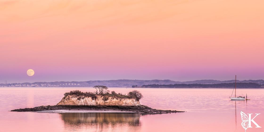
China Camp represents a unique partnership between the State of California and a local nonprofit organization, Friends of China Camp (FOCC) who took over operations of the park in 2012 to save it from being closed due to budgetary issues. The park consists of a campground, beach, multiple day-use areas, a multi-use trail system, and the historic site of the shrimping village which serves as a museum today. It’s really amazing how much there is to explore within the park given its relatively small size.
Maps and Planning
Please feel free to use this interactive map of the China Camp area, including the adjacent San Pedro Mountain Preserve and Harry Barbier Memorial Park. If you use your smart phone, GPS, or GPS watch for navigation, the map will allow you to download these routes. If you’d like to know more about doing that, check out this post on mapping and navigation. By the way, I’m not affiliated with Caltopo, but I’ve used their products and services for years. I trust and recommend them.
Things to Know
The trails at China Camp are great hiking and running routes as long as you don’t mind sharing with mountain bikers. Although these trails are also open to equestrians, it’s rare to encounter horses, probably due to the amount of bike traffic the trails are known for. Please respect the rules so everyone can recreate safely. Dogs are not allowed on any single track trails in the area, although leashed dogs are allowed on the fire roads adjacent to China Camp and in day use areas. The chances of seeing wildlife, including deer, turkeys, coyotes, bobcats, snakes, lizards, and newts (etc) is very high, especially early in the morning or late in the afternoon. It’s not a bad idea to layer up for the coastal weather, but don’t expect it to be perpetually cool like SF; summer time temps are commonly in the 80s and can be even higher.
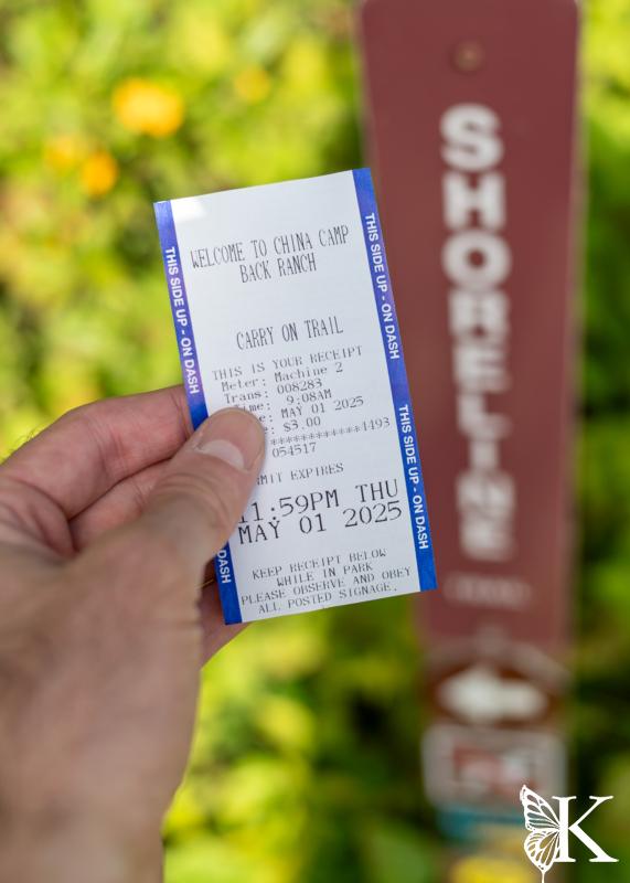
Parking and Trail-Use Fees
There is plenty of free parking near the campground entrance alongside San Pedro Road. There are also a few turnouts around Turtle Hill and Bullet Hill that offer free parking. All of the day use areas are paid parking (via kiosk). If you plan to use the trails, there is an additional fee (a few dollars) which can be paid at any of the kiosks. Season passes are also available. It’s very unlikely anyone will bother about your trail pass, but please do the right thing by paying the reasonable fee to help with the costs of maintaining and managing the park.
Mountain Biking
China Camp is one of a small number of spots in Marin where there are single track trails that bikes are allowed on. A popular forested loop of about 10 miles can be put together using Shoreline Trail, Bayview Trail, Oak Ridge, and Shoreline again, riding counter-clockwise. This is easy to access from the campground entrance, where there is also a kiosk to pick up a day use pass.

These trails are rated “green” (for beginners) on TrailForks but there are a couple of things to note. First there is a decent amount of climbing, so bring your climbing legs and lungs. Although the trails start out very mellow and relatively smooth, but they do feature some small rock gardens — combined with some exposure to a steep drop off, the upper part of the Bayview may make newer riders a little nervous. Having said that, my son learned to ride here when he was 10; he just walked any sections that he didn’t feel confident on.


Taking the detour up Echo Trail (and then following the fire road uphill) will take you to the top of China Camp. There are still remnants of the WWII missile site up here. There are also nice views of Mt. Tam. From here, riders can access “the backside,” which is not technically part of China Camp, or follow the paved access road down to Ridge Fire Trail to connect back up to Bayview. The top part of this descent is rough and steeper — it might be a bit much for beginners, but intermediate and advanced riders will enjoy picking lines and catching some air over what would best be described as a “bad jeep road!” All in all, this is a fun ride full of nice views.
Hiking and Running
China Camp is a great spot for hiking and running, even with the popularity of biking; I have never had an issue (I run and bike there). It offers everything from a wheelchair accessible trail, to longer routes over rougher terrain. Pack a lunch and visit the beach or eat at any of the day use areas!

Accessible Option (No Spice)
- 2.2 miles (loop)
- 120 feet of climbing
- Water at the campground, no water on trail
- Restrooms at the campground and portables at Miwok Meadows
These trails have recently been graded and widened to meet standards for accessibility. They can be done as an out-and-back, or as a loop, using the dirt shoulder of San Pedro Road to return (which is wide and has relatively light traffic but may not work for individuals in wheelchairs). From the Turtleback Hill turn out, hop onto Shoreline Trail and follow it to the large group day-use area known as Miwok Meadows. Double back from there — or continue down the fire road to reach San Pedro Road, then follow it back. An optional add-on is the Turtleback Hill Loop, which is also an accessible trail on the north side of San Pedro road across from the turnout. This is a great path for an easier run or hike with nice views through the forest.
Bayview + Shoreline Trails (Mild Spice)
- 3.4 miles (loop)
- 250 feet of climbing
- Water at the campground, no water on trail
- Restrooms at the campground and portables at Miwok Meadows
Starting on San Pedro road, near the campground entrance, you can hop onto Shoreline and then Bayview Trail. It will fork early on, take the lower fork to the left, cross the group camping area, then follow the trail as it switchbacks up the forested hillside. This will skirt around and above the campground, through the Madrones and Bay Laurel trees, eventually connecting to Shoreline Trail, which is an accessible trail that continues winding through the forest. Follow Shoreline past Miwok Meadows, down to San Pedro road, then back along the road to the campground entrance.

Bayview + Oak Ridge + Shoreline Trails (Medium Spice)
- 8.2 miles (loop)
- 850 feet of climbing
- Water at the campground, no water on trail
- Restrooms at the campground and portables at Miwok Meadows.
This is the classic loop that a lot of locals refer to as the “frontside” loop. While it offers a beginner to intermediate mountain biking experience, it presents a challenging run with a long, steady climb, then fast downhill sections that give way to gently rolling trails at the bottom — a good route to test your fitness on, to be sure! For hiking, it’s a great choice as long as you’re up for the mileage, you can carry enough water for the journey. Regardless of your mode of travel, this is one of the classic routes in Marin that everyone should do at least once. Spring is the best time of the year, but it can work in any season. Be aware that it can be a hot one in Summer.
Frontside + Backside Loop (Spicy)
- 12.3 miles (loop)
- 1750 feet of climbing
- Water at the campground, no water on trail
- Restrooms at the campground and portables at Miwok Meadows.
This is a great loop for people who are in excellent shape and looking for more distance and challenge. It’s one of my favorites to run during or after the rain. It’s also good riding; however, the backside trails are narrow and all have some degree of exposure, so do your homework. I’m not going to give much of a play by play; there’s a lot going on here. Do prepare for a lot of climbing! You will be reward with views of the bay and Mt. Tam, as well as lots of forest time, including a short stretch through some redwoods. I strongly recommend taking some sort of map and/or navigation aid. The backside trail network can be very confusing and is unsigned outside of the China Camp boundary.

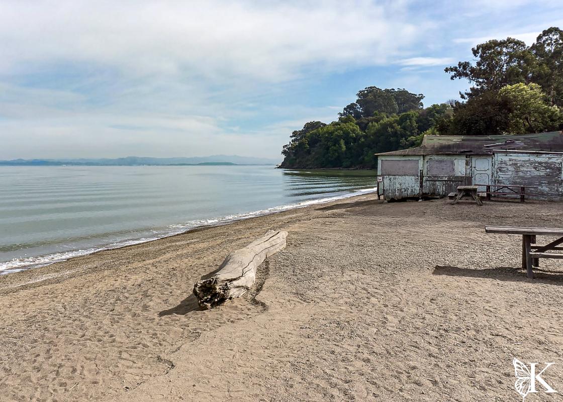
The Beach and Museum
The compact nature of China Camp means you can come for the trails, beach, or to learn about the cultural history of the area — or do all of the above. The beach is a cool area to kick back with picnic tables, a snack shop (open weekends only), some shade, and of course, access to the water. There are no strong currents or surf here, so it’s a great swimming and paddling spot. The beach is made of fine pebbles; sandals are advisable. There is a small fee for parking with limited spots available directly at the beach and more in the parking lot above it.
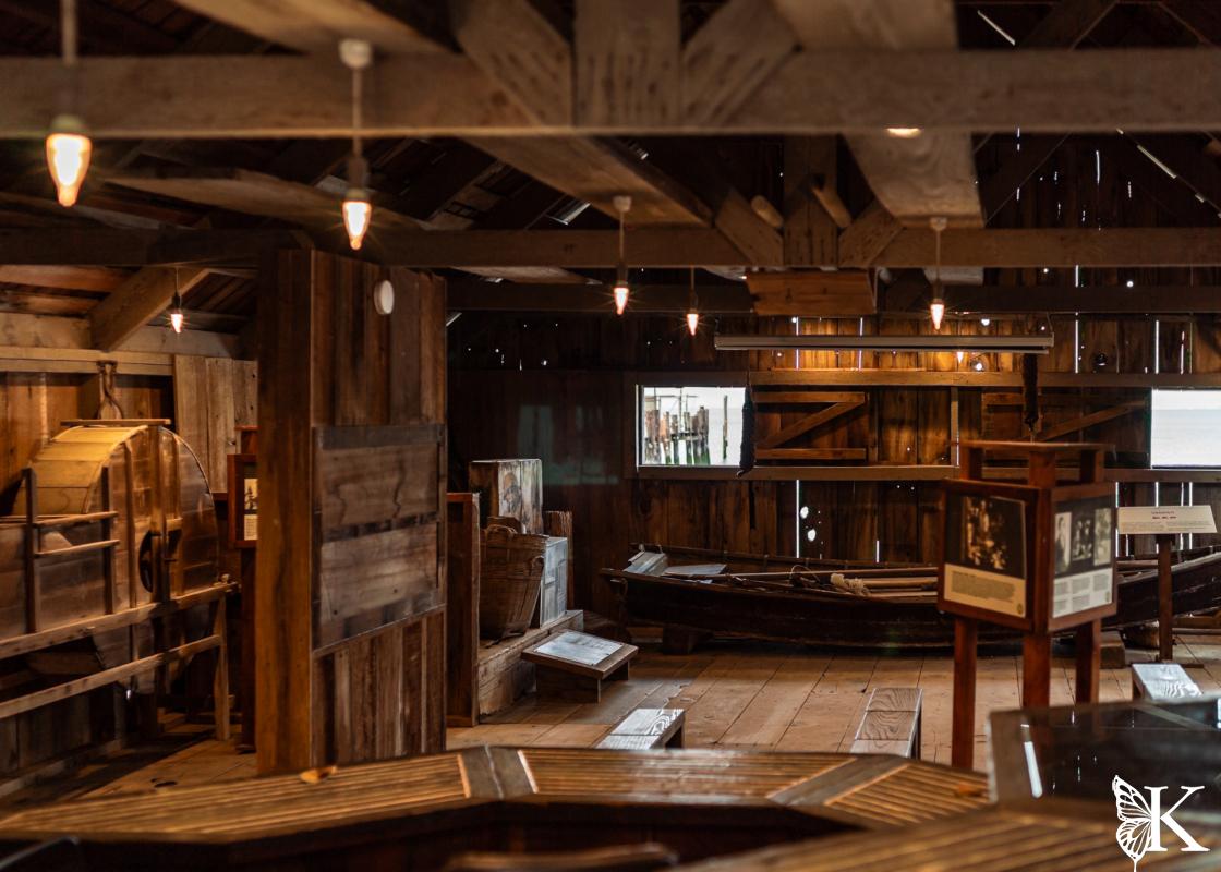
This area was once home to the Coast Miwok people, and later, Chinese Immigrants who relocated to the area for cultural connectedness. They created a shrimping industry on this very spot. You can visit the on-site museum to learn the lore of area that Huell Howser once featured on California’s Gold (RIP, Huell). Frank Quan was the last person to have been part of the China Camp shrimping village who still lived on site, up until his death in 2016 (RIP, Frank). I was fortunate to have met him and talked to him on a couple of occasions when I visited the beach during my runs.


That’s a Lot to Do!
Yep! China Camp offers something for everyone. It’s a fantastic resource for locals and a great spot to visit for a change of scenery with easy access, accessible trails, and reasonable fees. Give it a chance and see for yourself!